• Attraction Places
    • Khans & Castles
    • Hamams
    • Monuments
    • Mosques – Churches – Religious centers
    • Museums & Palaces
    • Parks – Walking Paths
    • Sites & Squares
  • Activities
    • Must Do
    • Shopping Centers
    • Super Markets
    • Sports
    • Adventures
    • Kids Zone
  • Sea
    • Activities on Water
    • Beaches
  • Villages
  • Where to Stay
  • Taste
    • Restaurants
    • Cafes
    • Desserts & Patisserie
    • Night Life
  • Agenda
  • Articles
  • Quick Links
    • About Us
    • About Saida
    • History of Saida
    • Geography
    • Economy & Education
  • Contact Us
  • Languages
Sign in or Register

حارة صيدا Verified listing Verified listing

  • General Info - معلومات عامة
  • prev
  • next
  • Share - مشاركة
  • prev
  • next
Description - وصف

تشرف على مدينة صيدا، ووصلت بها درجة التوأمة الى ان استعارت نصفها الآخر منها. وترفــض التنازل عن اسمها وتتباهى بذلك الاهتمام اللامحدود باحوالها

تـتـبـع حارة صيدا لمحافظة الجنوب، قضاﺀ صيدا. تبعد نحو 43 كلم عن بيروت. ولا يتجاوز ارتفاعها عن سطح البحر اكثر من 50 متراً.

تعتبر حارة صيدا همزة وصل بين العديد من المناطق، ولــذا لها دور مميز على اكــثــر مــن صعيد. هي نقطة وصــل بين مدينة صيدا في الجهة الغربية وبلدة عين الدلب في الجهة الشرقية، وبلدة الهلالية في الجهة الشمالية، وبلدة المية ومية في الجهة الجنوبية، وهذا ما يمنحها دوراً فعالاً على الصعد الاقتصادية والاجتماعية والسياسية بين صيدا واقليم التفاح والجنوب منذ عهود قديمة، بدليل وجود عائلات عاملية فيها.

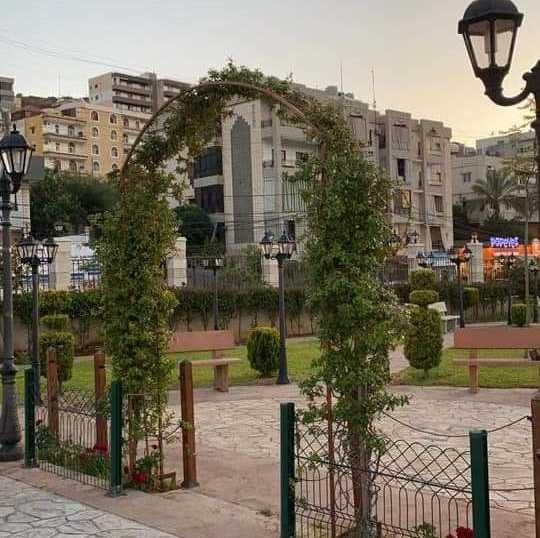
تجمع حارة صيدا بين خصائص البلدة الساحلية وخصائص البلدة الجبلية، فهي على بعد كيلومتر واحد فقط في مدينة صيدا، وفيها تلة ترتفع مئة وخمسة وسبعين متراً على سطح البحر وهي التلة التي يوجد فيها مدفع رمــضــان، ولذلك فهي مقصد السائحين وطالبي النزهة، بحكم مناخها اللطيف واتــســاع المساحات الخضراﺀ فيها، ووجــود عدد من المغاور والمعالم السياحية، عــلاوة على انها مقصد المؤمنين من مختلف الطوائف لوجود مزارين دينيين فيها هما: مقام النبي يحيى وكنيسة النبي الياس.

يبلغ عدد سكان حارة صيدا نحو 12 الــف نسمة، وتــضــم مجموعة مــن الــعــائــلات مــن اكــبــرهــا الــزيــن، قلقاس، الجبيلي، عيد، هاشم، صالح والسارجي. لحارة صيدا مجلس بلدي منتخب فــي الــعــام 2004 برئاسة السيد سميح الزين. تعد البلدة من البلدات الزراعية، تنتج ما تنتجه المنطقة كلها مــن حــبــوب، خضار وفاكهة. غير انها تشهد، منذ عقود، تحولاً نحو قطاعات اقتصادية اخرى كالبناﺀ والصناعة، ويكثر من ابنائها، الاطــبــاﺀ والمهندسون والمحامون، الامر الذي يفسر اقبال الاهالي على التحصيل العلمي. ويتوزع السكان في الحارة على خمسة: احياﺀ حي النبي يحيى، وحي مار الياس، وحي البيدر، وحي الحوطة، وحي العين، وتصل بين هذه الاحياﺀ شوارع منها الرئيسي الــذي يشكل ممراً لابناﺀ المناطق المجاورة، ومنها الداخلي، وهي شوارع تقوم بلدية حارة صيدا بتطويرها. اقتضى الازدياد السكاني في حارة صيدا توسعاً عمرانياً، زاد مــن مسؤوليات المجلس البلدي، فالبلدة، كما يقول رئيس البلدية السيد سميح الزين ونائبه السيد جمال قلقاس، تشهد توسعاً عمرانياً ملحوظاً من العام 1985. في الجهة الغربية وعند سفوح تلة مار الياس قريباً من مقام النبي يحيى ومقام النبي الياس، ثم ازداد هذا التوسع في التسعينات شرقاً في المنطقة المعروفة بـ “تعمير الحارة”.كان في انتظار المجلس البلدي تاريخ من الحرمان والاهمال المزمنين وعليه كان على المجلس ان يعوض هذا الحرمان بانجازات استئنائية اقتضتها ايضاً موجبات الازديــاد السكاني والتوسع العمراني. ومن ضــمــن الــمــشــاريــع الــتــي اتــخــذهــا المجلس الــبــلــدي قــــراراً بتسمية الاوتوستراد الالتفافي الذي يحيط بحارة صيدا باسم “شارع الرئيس نبيه بري”، كما اتخذ قراراً آخر باطلاق اسم “شارع الجيش” على الشارع الممتد بين شمال البلدة وجنوبها، تقديراً لتضحيات الجيش ولوقوع الشارع بــالــقــرب مــن ثكنة الــجــيــش. يؤكد رئيس المجلس البلدي “ان الدعم غير المحدود من قبل الرئيس نبيه بري ومجلس الجنوب، كان المحرك الاســاســي للمشاريع التي انجزت، والمشاريع التي يجري تنفيذها في اطــار الخطة الانمائية الشاملة الــتــي وضعتها الــبــلــديــة”. يعدد رئيس البلدية الانــجــازات ويوضح “الى انه وبالاضافة الى الاوتوستراد تم تأهيل طريق الـــوادي القديم، وتوسيع وتزفيت الطرق الداخلية، وبناﺀ جدار دعم له وظيفة تجميلية ايــضــاً، مــع اشـــارات الــمــرور والانـــارة العامة في الشوارع كافة، ومع الحواجز الوسطية وتخطيط الشوارع باللون الفوسفوري، وانشاﺀ الارصفة”. كما قام بتنفيذ مشروع شامل لشبكات الــصــرف الــصــحــي الــجــديــدة، تفي بحاجات التوسع العمراني، وهذا يشمل الاحياﺀ كلها.تتعاون البلدية مع المؤسسات الــحــكــومــيــة عــلــى تنفيذ الــعــديــد من المشاريع، ومنها بناﺀ ثانوية نموذجية على سفح تلة مار الياس، يستفيد منها طــلاب حــارة صيدا وطلاب البلديات والقرى المجاورة. كما تمت الموافقة من مجلس الجنوب على ترميم ودعم وتجميل مدرسة حارة صيدا المتوسطة الرسمية، وقد رصــد لذلك مبلغ 140 مليون ليرة لبنانية. ومــن بين المشاريع التي يجري تنفيذها مشروع ذو طابع بيئي وتجميلي، وابرزها التشجير وانشاﺀ الحدائق عند المداخل وفي، الاحياﺀ مع تشجير الجزر الوسطية وانــارة كل ذلــك، بحيث يشكل عامل دفع للنشاط السياحي في البلدة، ويتعزز ذلك بحل مشكلة النفايات بالتعاون مع اتحاد بلديات الزهراني.يطلق على اسم النبي يحيى ابن زكريا. يوجد المقام في حارة صيدا تبركاً، فيما تؤكد المصادر ان جثمان النبي يحيى مدفون في فلسطين ورأسه مدفون في الجامع الاموي في دمشق. يقع المقام على تلة تشرف على مدينة صيدا وهو غرفتان يتجلى فيهما طابع الــعــمــارة القديم ذي العقود والقباب، تحيط بها حديقة زاخرة بأنواع الاشجار المثمرة، وفي الداخل قبر ومحراب ومحامل للقرآن الكريم وكتابات تشتمل على آيات قرآنية اضافة الــى اسماﺀ الرسول وصحابته الاكرمين.هو جزﺀ من كنيسة مار الياس الواقعة ايضاً على تلة مشرفة.والكنيسة واحدة من كنائس كثيرة في لبنان شيدت على اسم النبي الياس (او النبي ايليا) المعروف عند المسلمين باسم الخضر، وتعلل المصادر ذلك بأن النبي الياس زار المنطقة الجنوبية من لبنان بأمر من الرب، واقام مدة في الصرفند الواقعة الى الجنوب من مدينة صيدا، او في صريفا بحسب مصادر اخرى. ومقام النبي ايليا مزار يقصده المسيحيون من مختلف المناطق اللبنانية، للتبرك، كما يقصده السائحون وطلاب النزهة.

Categories - التصنيفات
  • البلدات
Place Location - موقع المكان

[sc name="haret-saida22" ][/sc]

You May Also Be Interested In

بنعفول Verified listing

تقع بنعفول في قضاء صيدا على متوسط ارتفاع 300 م عن سطح البحر، وعلى مسافة 56 كلم عن بيروت, و17 كلم عن صيدا،…
  • البلدات
  • Quick view
  • Bookmark

العدوسية Verified listing

العدوسية هي إحدى القرى اللبنانية من قرى قضاء صيدا في محافظة الجنوب. مساحتها 4,20 كلم2 عدد سكانها 874 تشتهر…
  • البلدات
  • Quick view
  • Bookmark

المروانية Verified listing

المروانية بلدة من أعمال جبل عامل في جنوب لبنان. تتبع إدارياً لقضاء صيدا كانت ابان الحكم العثماني مركز إدارة…
  • البلدات
  • Quick view
  • Bookmark

Haret Saida Verified listing Verified listing

  • General Info - معلومات عامة
  • prev
  • next
  • Share - مشاركة
  • prev
  • next
Description - وصف

It supervises the city of Sidon, and it reached the degree of twinning until it borrowed the other half from it. She refuses to give up her name and flaunts that unlimited attention to her condition

Haret Sidon belongs to the South Governorate, Sidon District. It is about 43 km from Beirut. Its height does not exceed 50 meters above sea level.

Haret Saida is considered a link between many areas, and therefore it has a distinct role on more than one level. It is a link point between the city of Sidon on the western side, the town of Ain El-Delb on the eastern side, the town of Al-Hilaliya on the northern side, and the town of Mieh Mieh on the southern side. Working families.

Haret Sidon combines the characteristics of a coastal town and the characteristics of a mountain town, as it is only one kilometer away in the city of Sidon, and it has a hill that rises one hundred and seventy-five meters above sea level, and it is the hill where the Ramadan cannon is located, and therefore it is the destination of tourists and picnic seekers, due to its pleasant climate and vastness The green spaces in it, and the presence of a number of caves and tourist attractions, in addition to that it is the destination of believers of different denominations because there are two religious shrines in it: the shrine of the Prophet Yahya and the Church of the Prophet Elias.

The population of Haret Sidon is about 12 thousand people, and it includes a group of the largest families: Al-Zein, Qalqas, Al-Jubaili, Eid, Hashem, Saleh and Al-Sarji. Sidon has a municipal council elected in 2004, headed by Mr. Samih Al-Zein. The town is considered one of the agricultural towns, and it produces all the grains, vegetables and fruits that the region produces. However, for decades, it has witnessed a shift towards other economic sectors such as construction and industry, and many of its sons are doctors, engineers and lawyers, which explains the families' demand for educational attainment. The population in the neighborhood is divided into five: the neighborhoods of the Nabi Yahya neighborhood, the Mar Elias neighborhood, the Baydar neighborhood, the Al-Houta neighborhood, and the Al-Ain neighborhood, and these neighborhoods are connected by streets, including the main one, which forms a corridor for the residents of the neighboring areas, including the interior, which are streets that the municipality of Haret Sidon is developing. The population increase in Haret Sidon necessitated an urban expansion, which increased the responsibilities of the municipal council. The town, according to the mayor, Mr. Samih al-Zein and his deputy, Mr. Jamal Qalqas, has witnessed a remarkable urban expansion since 1985. On the western side and at the foothills of Mar Elias Hill, close to the shrine of the Prophet Yahya The shrine of the Prophet Elias, then this expansion increased in the east in the nineties in the area known as “reconstruction of the neighborhood.” The municipal council was waiting for a history of chronic deprivation and neglect, and the council had to compensate for this deprivation with exceptional achievements that were also required by the requirements of population growth and urban expansion. Among the projects that the Municipal Council has taken is a decision to name the bypass highway that surrounds the seas of Sidon as “President Nabih Berri Street.” It also took another decision to name the street extending between the north and south of the town, in appreciation of the army’s blockade of the street. . The head of the municipal council confirms that “the unlimited support from President Nabih Berri and the Council of the South was the main driver of the projects that have been completed and the projects that are being implemented within the framework of the comprehensive development plan set by the municipality.” The mayor enumerates the achievements and clarifies that “in addition to the highway, the old valley road was rehabilitated, the internal roads were widened and asphalted, and a support wall was built that also has a cosmetic function, with traffic lights and public lighting in all streets, median barriers and street planning in phosphorous color, and the construction of paving.” . He also implemented a comprehensive project for new sewage networks, to meet the needs of urban expansion, and this includes all neighborhoods. . The South Council also approved the restoration, support, and beautification of the Haret Saida Public Intermediate School, and an amount of 140 million Lebanese pounds was allocated for this. Among the projects that are being implemented is a project of an environmental and cosmetic nature, the most prominent of which is afforestation and the establishment of gardens at the entrances and in the neighborhoods with the afforestation of the central islands and lighting all of that, so that it constitutes a driving factor for the tourism activity in the town, and this is reinforced by solving the waste problem in cooperation with the Union of Al-Zahrani Municipalities. On the name of the Prophet Yahya Ibn Zakaria. The shrine is located in the Sidon neighborhood for blessing, while the sources confirm that the body of the Prophet Yahya is buried in Palestine and his head is buried in the Umayyad Mosque in Damascus. The shrine is located on a hill overlooking the city of Sidon, and it consists of two rooms in which the character of the ancient architecture with arches and domes is evident, surrounded by a garden full of types of fruit trees, and inside is a tomb, a mihrab, bearings for the Holy Qur’an and writings containing Quranic verses in addition to the names of the Prophet and his honorable companions. It is part of a church. Mar Elias is also located on an honorable hill. The church is one of many churches in Lebanon that was built after the name of the Prophet Elias (or the Prophet Elijah), known to Muslims as Al-Khidr, and the sources justify this that the Prophet Elias visited the southern region of Lebanon by order of the Lord, and lived for a period in Sarafand Located to the south of the city of Sidon, or in Srifa, according to other sources. The shrine of the Prophet Elijah is a shrine visited by Christians from various Lebanese regions to seek blessings, as well as by tourists and excursion students.

Categories - التصنيفات
  • Villages
Place Location - موقع المكان

[sc name="haret-saida22"][/sc]

You May Also Be Interested In

Binaeful Verified listing

Benafoul is located in the Sidon district, at an average altitude of 300 m above sea level, at a distance of…
  • Villages
  • Quick view
  • Bookmark

Al-Adawsiyah Verified listing

Al-Adawsiyah is one of the Lebanese villages of Sidon District in the South Governorate. It has an area of…
  • Villages
  • Quick view
  • Bookmark

Merouaniyeh Verified listing

Al-Marwaniyah is a town in the works of Jabal Amel in southern Lebanon. Administratively affiliated to Sidon…
  • Villages
  • Quick view
  • Bookmark
  • Facebook
  • X
  • WhatsApp
  • Telegram
  • Copy link
  • Facebook
  • X
  • WhatsApp
  • Telegram
  • Copy link